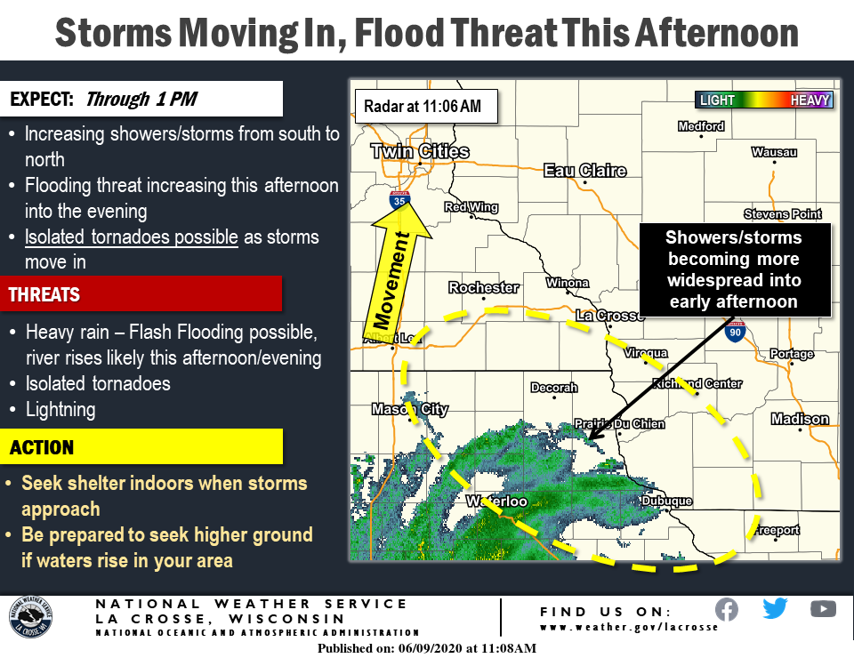
Heavy rain, flooding likely this afternoon and tonight, with tornadoes possible
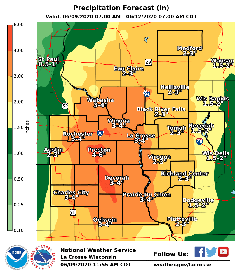
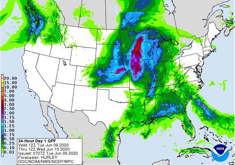
Tuesday-Wednesday rain forecast.
Press Staff Report
The remnants of Tropical Depression Cristobal will bring widespread heavy rainfall this afternoon and evening to the Charles City area, with areas of flooding likely, according to the National Weather Service.
A few tornadoes are also possible.
Strong winds are likely on Wednesday, with potential river flooding through late week.
Pay close attention to weather conditions through Tuesday night.
TUESDAY AFTERNOON-TONIGHT: HEAVY RAIN, FLOODING, A FEW TORNADOES
What: 1-3″ widespread rainfall – localized 6″ or more possible. A few tornadoes also possible. A Flash Flood Watch is in effect.
Where: Entire area. Higher threat for heavy rain near and west of the Mississippi River. Tornado threat mainly south of I-90.
Timing: Heaviest rain and tornado threat this afternoon and evening.
Impacts: Flash flooding could develop quickly into tonight! Expect ponding of water on roadways. Storm sewers may back up. Mud and rock slides possible in hilly terrain. Any tornadoes may cause damage to trees, structures, etc. Power outages possible. Flooding of streams and rivers could develop into mid and late week.
ACTION: Have a plan in place in case flooding develops or warnings are issued. Be sure to have multiple ways to receive warnings.
WEDNESDAY: STRONG NORTHWEST WINDS
What: Northwest winds gusting 35 to 45 mph.
Where: Strongest over northeast Iowa and southeast Minnesota.
Impacts: With wet soils, trees could be more easily damaged or blown over. Power outages possible if power lines are damaged. Difficult travel for high profile vehicles.
Take steps to protect your property from the strong winds!


Social Share