Tornadoes, flooding torment Floyd County area in early weekend storms

By Bob Steenson, bsteenson@charlescitypress.com
Two tornadoes were confirmed near Marble Rock during storms early Friday evening.
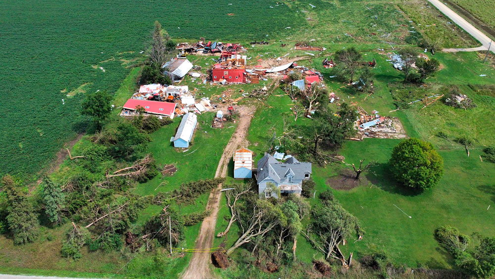
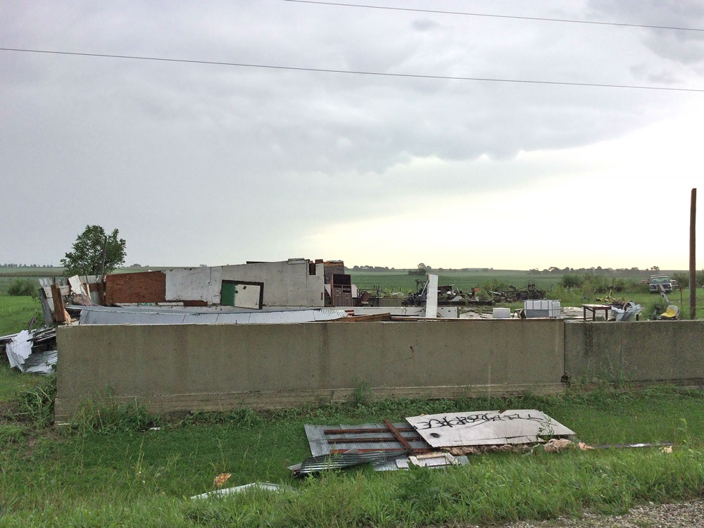
An EF1 tornado with peak winds estimated at 105 mph touched down just west of Marble Rock at 5:58 p.m. and traveled 3.2 miles, crossing to the south and southeast of town. The maximum width was 135 yards.
“Besides damage to crops and trees, several farms and homes were damaged. One farm southeast of town had nearly every building destroyed,” the National Weather Service said in its report.
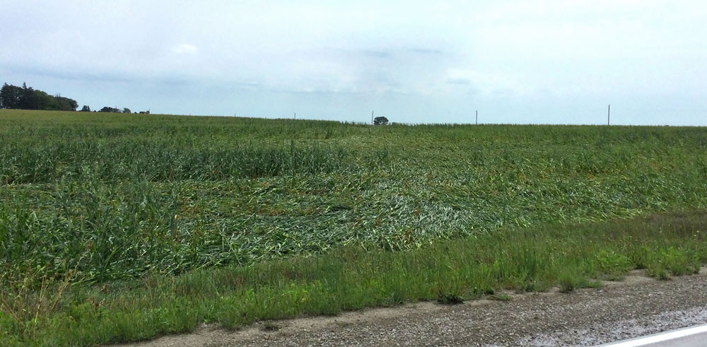
A little earlier, a less powerful EF0 tornado had touched down about 4 miles west of Marble Rock along 270th Street.
The tornado had estimated peak winds of 75 mph, traveled a mile and had a maximum width of 45 yards.
“Damage was mainly to crops but one nearby farm had some damage to an outbuilding roof,” the National Weather Service said about this twister.
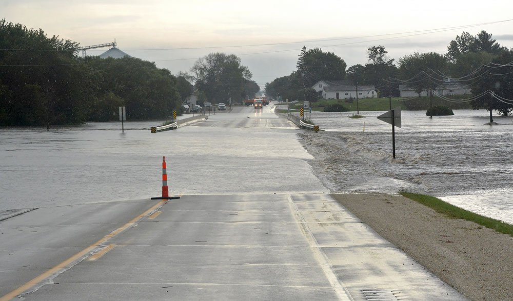
The wider threat for the area was the potential of flooding, with torrential rains dropping up to a foot of precipitation in some areas over a three-day period beginning Friday.
On Monday, Gov. Kim Reynolds issued a disaster proclamation for 11 counties, including Floyd and Chickasaw. The other counties were Allamakee, Buchanan, Cerro Gordo, Clayton, Emmet, Howard, Lyon, Palo Alto and Winneshiek.
Bremer and Fayette counties, which also sustained damage from the most recent severe weather, had been previously included in a disaster proclamation issued Aug. 26.
The National Weather Service official report for Charles City was 4.9 inches of rain from Friday through 6 a.m. Sunday, but there were reports of much higher amounts in the area, including to the north, feeding into the Cedar River.
Estimated precipitation amounts for the 72-hour period ending Sunday afternoon were as high as 10 inches just east of Charles City, according to iweather.net, which uses Doppler radar technology and complex precipitation algorithms to produce “very accurate estimates of accumulated precipitation.”
Other three-day precipitation totals ending Sunday for area communities, according to iweather.net, were 8¾ inches in Colwell, 6½ inches in Nashua, 6 inches in Floyd, 5½ inches in Rockford, 5 inches in Nora Springs, 4¾ inches in Rudd, 3½ inches in Greene, and 3¼ inches in Marble Rock.
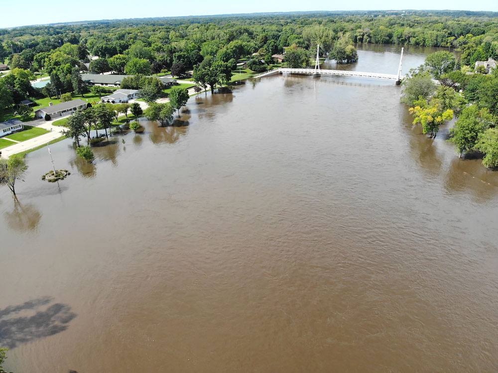
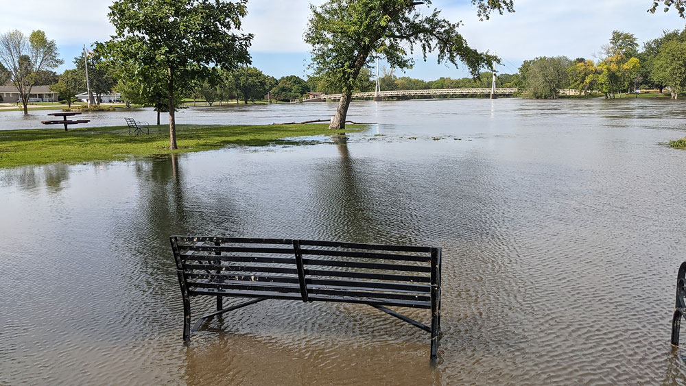
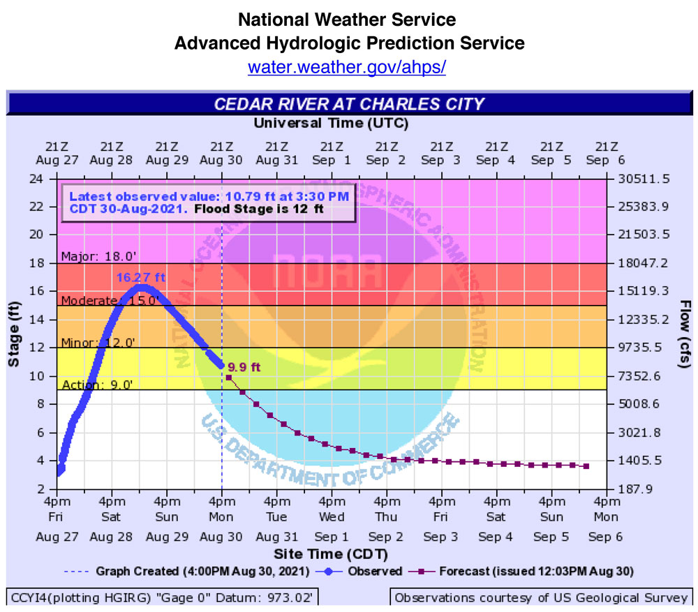
The Cedar River in Charles City crested at 16.27 ft. at 6:30 a.m. Sunday, but a flood warning continued through Monday evening. Flood stage is 12 feet.
The Charles City Police Department announced that it had temporarily closed Brackett Street south of Sportsmen’s Park on Saturday and was continuing to monitor the situation. That street is now open again.
On its Facebook page, the CCPD advised, “We realize you want to see it firsthand but please do not drive through it. We really dislike having to wade out to your car after it stalls to reinforce that you made a poor choice.  Be safe!”
By Monday evening the Cedar River was down below 9 feet at the Charles City gauge. It was predicted to drop to 6 feet by 1 a.m. Wednesday and keep declining to more seasonal levels through the end of the week.
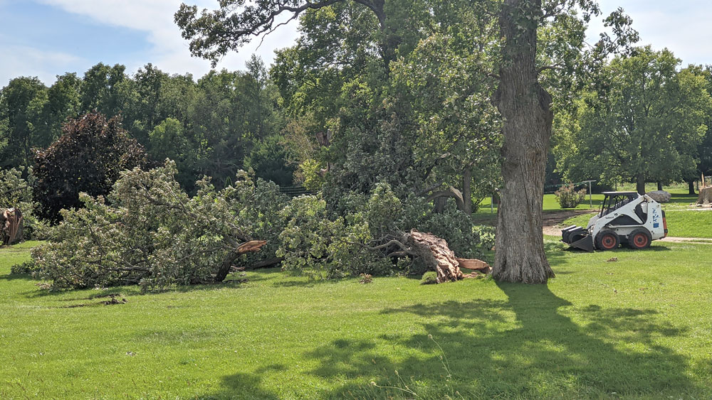
Floyd County Conservation announced that West Idlewild Park and Ackley Creek Campground are closed until further notice because of flooding in Colwell Park.
About 1,000 customers of MidAmerican Power were without power Friday, including many on the south side of Charles City, because of storm activity, the company said on its outage website.
Floyd County Engineer Dusten Rolando said Floyd County road damage mostly occurred in the northeast part of the county, with about 50 to 60 spots where water covered the roads, washing off rock.
He said about eight roads were closed over the weekend because of running water or water damage, and two roads remained closed Monday evening — Victory Avenue south of 155th Street where an area adjacent to a bridge washed out, and 110th Street by Rampart Avenue. Both roads are expected to be repaired and reopened in the next several days, he said.
Rolando cautioned motorists to be careful on county roads because there may be rough areas until they can be bladed.
“Anywhere where it washed over, be careful,” he said. He estimated total Floyd County road damage as probably between $50,000 and $100,000.
Rolando is also county engineer in Chickasaw County, and he said the road damage over there was the worst he had seen in his 20 years at that job.
“It’s bad, really bad, and it’s going to take us a while to get anywhere near back to normal,” Rolando said about Chickasaw County.
The flooding led to the closure of more than 30 roads in Chickasaw County on Saturday. In addition to county roads, Highway 18 west of New Hampton, Highway 18 on the west side of Fredericksburg and Highway 346 near the Wapsipinicon River were all closed to traffic for a good part of Saturday, and 346 didn’t reopen until Sunday afternoon.
The governor’s disaster proclamation provides grants of up to $5,000 for households with incomes up to 200 percent of the federal poverty level for a family of three. Grants are available for home or car repairs, replacement of clothing or food and temporary housing expenses.
The grant application and instructions are available on the Iowa Department of Human Services website at dhs.iowa.gov/disaster-assistance-programs. Potential applicants have 45 days from the date of the proclamation to submit a claim.
— Bob Fenske, editor of the New Hampton Tribune, contributed to this report.


Social Share