• FLOODING AND TORNADO DAMAGE PHOTO GALLERY
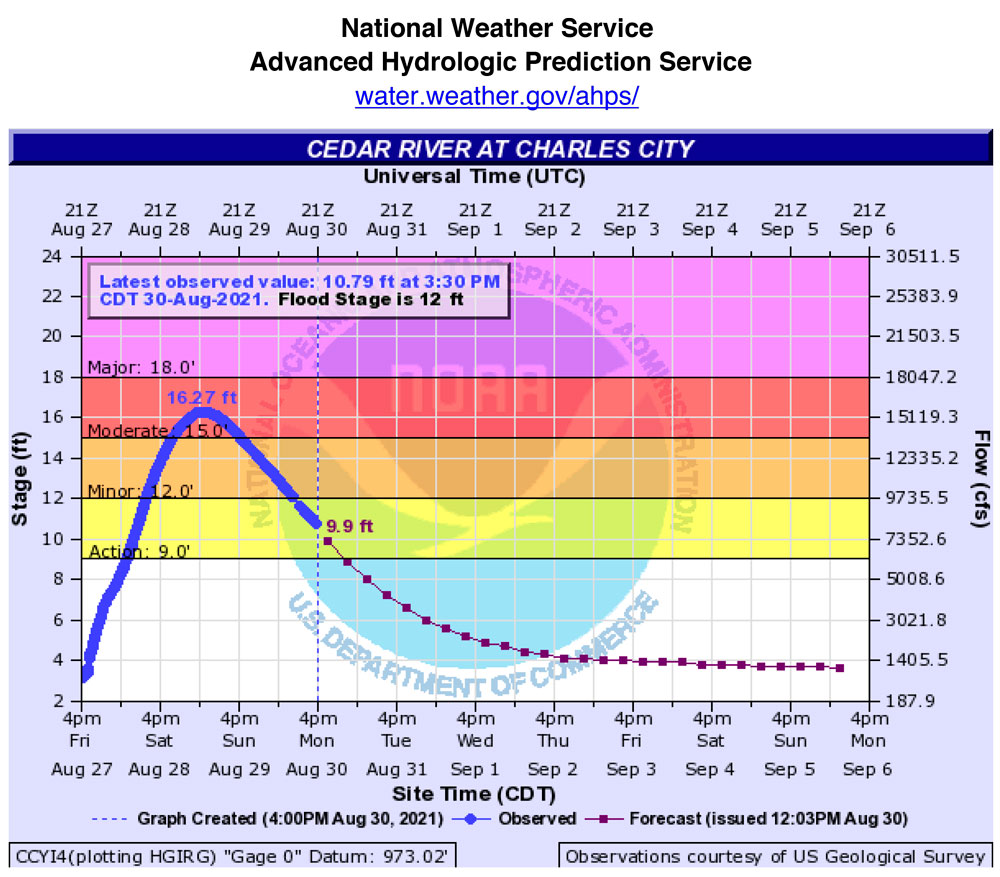
Cedar River gauge level, Charles City.
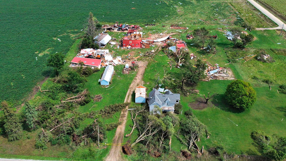
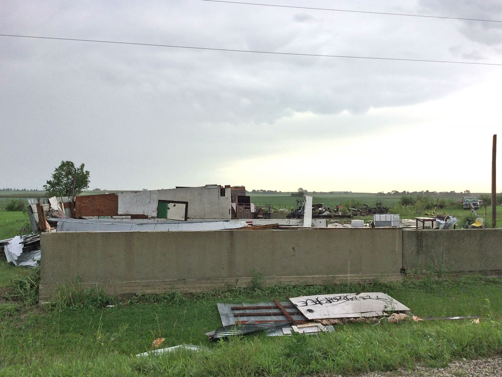
Tornado damage to a farmstead southeast of Marble Rock from Friday’s storms is shown in this photo posted on the National Weather Service website, credited to Nathan Santo Domingo. Photo by Nathan Santo Domingo
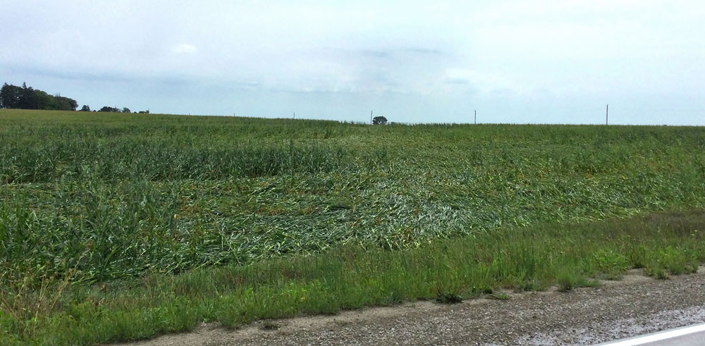
Crop damage from the path of a tornado near Marble Rock on Friday is shown in this photo by the National Weather Service. Submitted photo
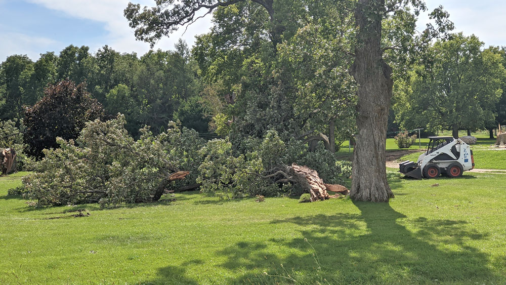
Tree damage from storms including two area tornadoes is shown at Lines Tree Farm near Marble Rock Sunday afternoon. Press photo by Bob Steenson
Damage is shown southwest of Marble Rock in this photo by the National Weather Service storm investigators. Submitted photo
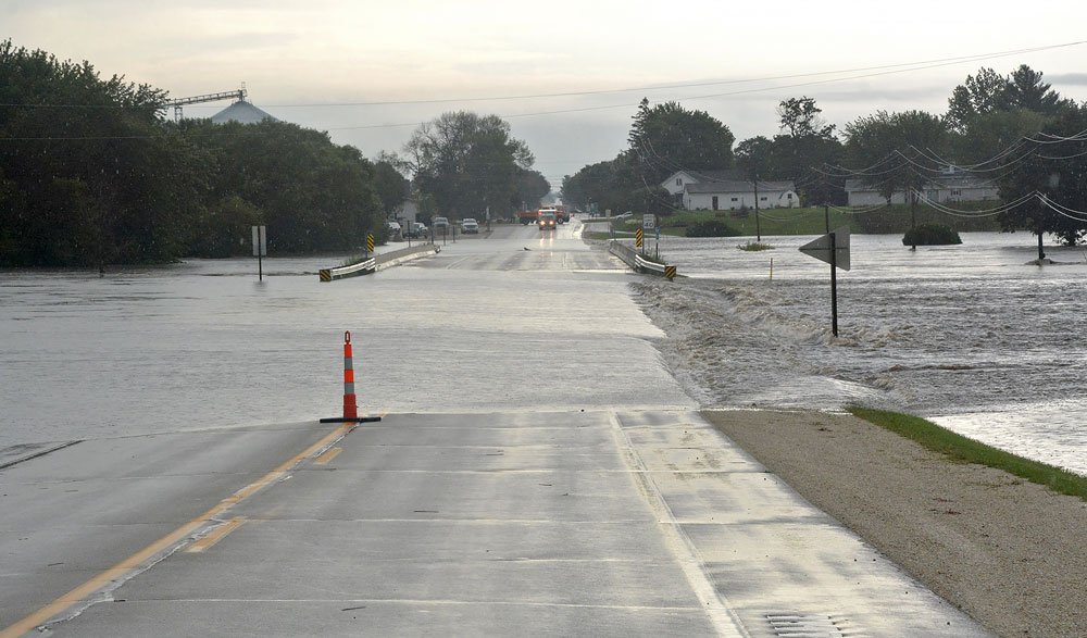
HIghway 18 on the west side of Fredericksburg is closed to traffic Saturday morning as water covers the highway. New Hampton Tribune photo by Bob Fenske
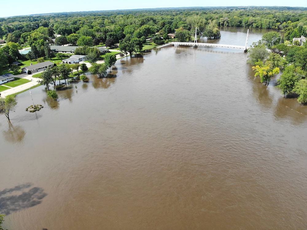
The Cedar River overflowed its banks over the weekend, flooding parts of Bayou Bend, Sherman and Kate McLeod parks in Charles City, after torrential area rains beginning Friday. Press photo by Bob Steenson
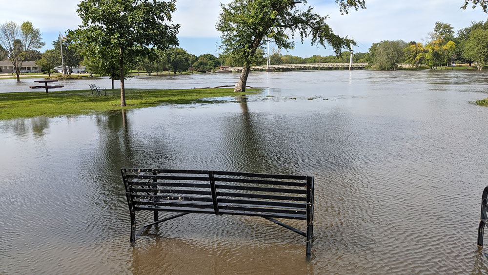
The Cedar River overflowed its banks over the weekend, flooding parts of Bayou Bend, Sherman and Kate McLeod parks in Charles City, after torrential area rains beginning Friday. Press photo by Bob Steenson
Cedar River gauge level, Charles City.
Tornado damage to a farmstead southeast of Marble Rock from Friday’s storms is shown in this photo posted on the National Weather Service website, credited to Nathan Santo Domingo. Photo by Nathan Santo Domingo


Social Share