CCMS social studies students create wall-sized 1913 plat map of Charles City area
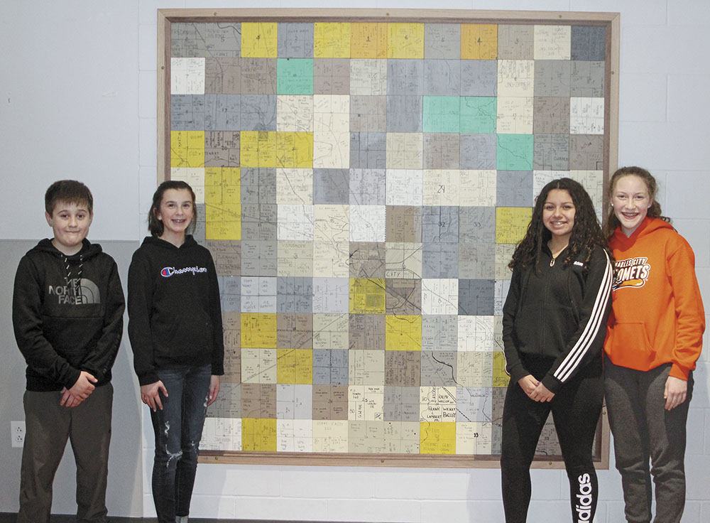
CCMS eighth-graders Evan Salinas, Madie Lensing, Anna Uriostegui and Maggie Boss pose with the 1913 plat map of part of Floyd County that they and their classmates all took part in building together. (Press photo James Grob.)
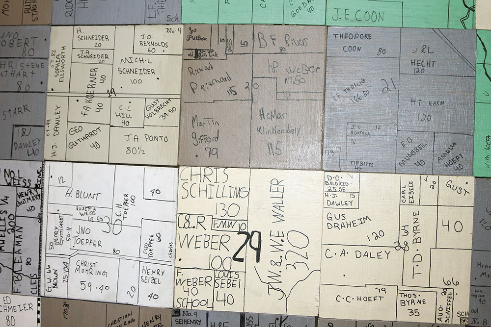
A closer look at the plat map of part of 1913 Floyd County which was built by students in a CCMS eighth-grade social studies class. (Press photo James Grob.)
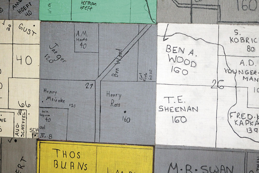
A closer look at the plat map of part of 1913 Floyd County which was built by students in a CCMS eighth-grade social studies class. (Press photo James Grob.)
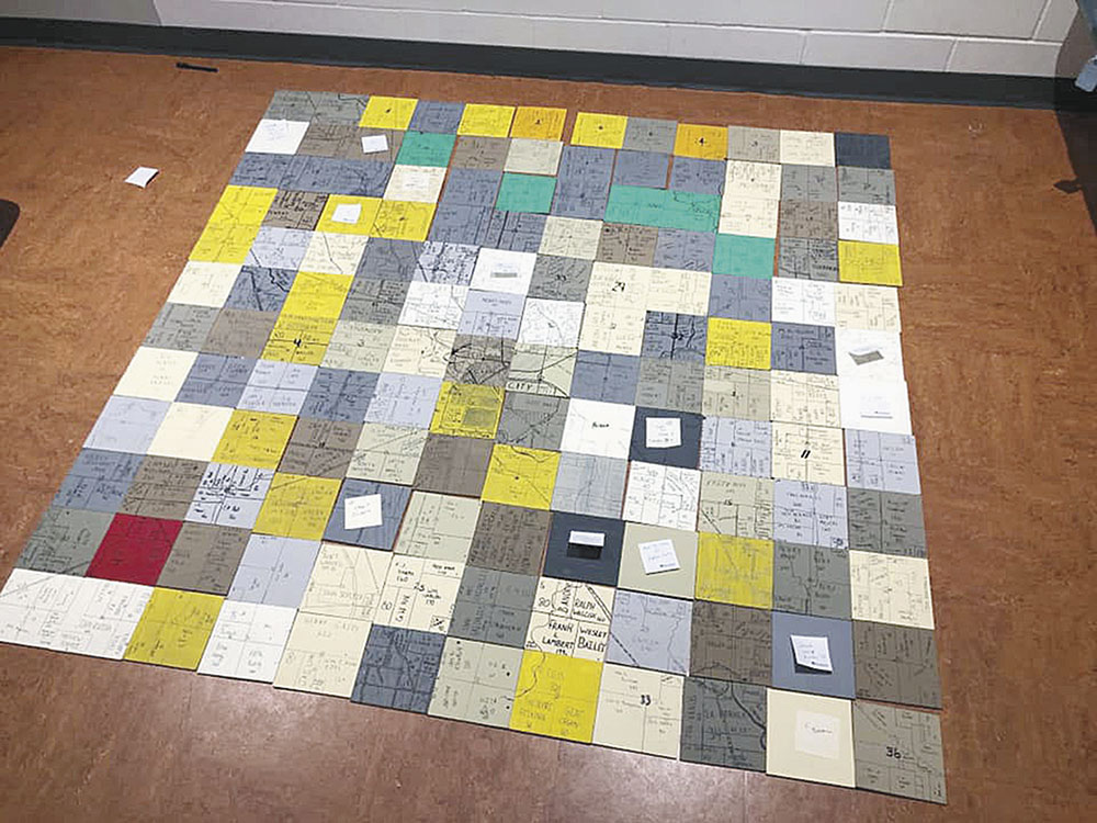
A CCMS eighth-grade social studies class all worked together to build a plat map of one section of 1913 Floyd County. (Photo submitted.)
By James Grob, jgrob@charlescitypress.com
It was 50 years after the Civil War and 50 years before the JFK assassination.
Richard Nixon was born and Harriet Tubman died.
The year was 1913, and here in Charles City, life mostly revolved around farming, the railroad and a new-fangled contraption being manufactured over at Hart-Parr Gasoline Engine Co., known as the “tractor.”
Although aerial photography of the area was unlikely then, how the land in Floyd County was laid out in 1913 can now be seen on a wall in the eighth-grade learning studio at Charles City Middle School, thanks to some CCMS social studies students.
As a part of a class project, about 135-140 of Ryan Rahmiller’s eighth-grade students each recreated a tile from a 1913 county plat map. Those tiles have now been mounted on the wall in the form of one huge map.
“It’s like a quilt — in the end, it isn’t all matched fabrics, but it looks so cool when it all pieces together,” said eighth-grader Anna Uriostegui. “I think Mr. Rahmiller comes up with some really cool ideas, and he’s a really good social studies teacher.”
Rahmiller said he was trying to come up with a project that would involve all 135-plus of his social studies students. In eighth grade, social studies focuses on culture, the settlement of the state of Iowa and settlement trends in the local area.
“As we do that, we often take a look at our local community and its history, and try to tie in a little bit about some of the names that they see of local streets and bridges and make some connections,” Rahmiller said. “Part of that conversation about settlement is about where people came from, and the reasons they came to this area in the first place.”
Rahmiller said the class addresses economic drivers behind settlement in Charles City, industry that would have drawn people here in the first place, and how population expanded in the area.
He found a plat map of the area that had been drawn up in 1913, and saw that it had a lot of names on it of people who were significant in Charles City’s history. The map also showed some of the area’s foundational blocks forming.
“I’m a fan of maps, because I like to have a little bit of a sense of where things are,” Rahmiller said.
Industrial tech teacher Jesse White cut individual 6-by-6-inch square tiles for the class, and students were each assigned a different tile. Every student chose a paint color and went about designing it to include all the detail from the map.
Rahmiller said, “Everybody’s got an identity in there.”
“It’s been kind of fun because we saw some patterns develop,” he said. “Some names are on there of people who we know — family members who settled around each other. We also started to see some things emerge, like how the Charles City Western Railway expanded and how it went out to Marble Rock.”
The map is a section that covers nearly one-half of Floyd County. Each of the blocks has roads and names of people who owned that section of land in 1913. Tiles also include the flow of the Cedar River and railroad routes.
Saturday, with the help of custodian Dave Bahe — who also is a master woodworker and helped create the framework around the map — it was mounted on the wall.
“It’s a collective piece of artwork of the students of this eighth-grade class they can view for years to come,” Rahmiller said. “It will be a permanent piece here in the gathering space that students and teachers can look at.”
Rahmiller said the class discovered some fun and interesting things through the project. One student found her great-great-grandfather’s name on the map. Another student, by happenstance, was assigned to create a tile of his own family property.
“The Carrie Lane Chapman Catt property is also on there, and that’s kind of neat, considering this year is the 100th year of women’s suffrage attaining the right to vote,” Rahmiller said. “It’s like any map — you have to kind of scour it and take a look around for names, and it’s fun. There’s a lot of different connections on there.”
Uriostegui said that when she began the project, she was a little hesitant because all the tiles didn’t precisely line up, but then she realized that it actually made the map better, because each tile was unique to each student.
“I really liked this project because everyone did their own piece and it was different,” Uriostegui said. “The way it all came together in the end, it was really dope to see that.”
Student Evan Salinas said he learned a lot about the history of Charles City while working on the project, though he struggled with lining up the railroad tracks and rivers on the map.
“You could outline with pencil, and then had to go back with permanent marker,” Salinas said. “If you messed up with the permanent marker, you had to start all over again. I messed up a couple times.”
Student Madie Lensing said she was happy with the final results.
“It’s really cool seeing it all together, and I got to learn a lot about Charles City history,” Lensing said.
Student Maggie Boss said her favorite part of the project was the fact that everyone in the eighth-grade class was involved.
“I learned a lot about teamwork, and that was very important to this project,” Boss said.


Social Share